We are now in Arthur’s Pass, an area tucked into a mountain pass in the central region. It’s heading into late fall, so it’s cooler and rainier. Our cabin is quite rustic, with a couple of small electric heaters that can’t really keep up with the cool temperatures. Fortunately we have a nice wood stove and plenty of wood, so getting a wood fire going is a daily routine. We hear the Keas calling each morning, it always sounds like they are frustrated about something. They have such expressive voices. We stayed for two weeks, which is probably a little longer than we needed to. There are a lot of hiking trails, but overall they are much more rugged than what we have encountered in the past. The type of trails where a 5 km, (3 mile) one way route is listed as a 5 hour hike. In all we had 5 days of heavy rain, sometimes 2 and 3 days in a row with low clouds many mornings. No wifi at this location so it was a good time to read books and online magazines we had downloaded previously.
Temple basin track, and upper hut
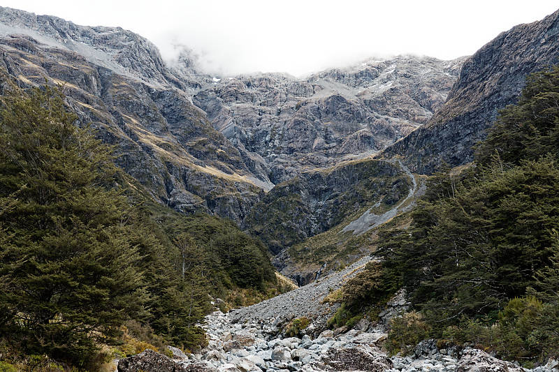
Today we did the Temple basin track, a moderate climb, and good trail. Deb climbed to the ski hut for lunch, and enjoyed beautiful views of Mt Rolleston across the valley. Tim continued up the trail for another hour, ascending a scree field using ropes. After that, the trail evened out and continued on to the surrounding valley, where there is another backpackers hut. The picture above is the first hut, taken from up the scree field.
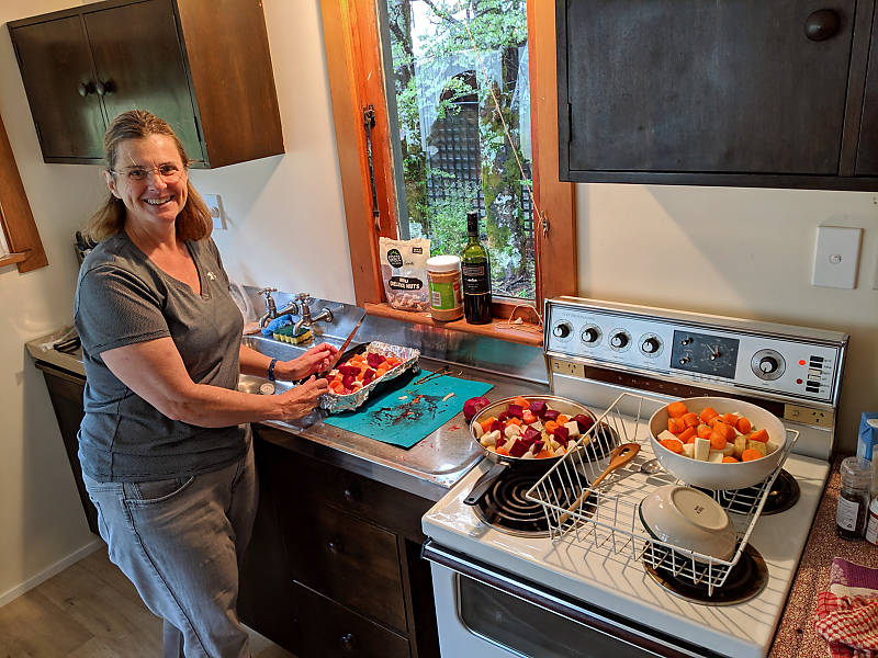
We then had 2 days of solid rain, never letting up. Real good soaker. For Easter, we fixed roasted veggies, and Deb prepared a leg of lamb to go with it. The roast veggies included potato, beets, carrots, parsnips, and Kumara, a type of sweet potato. We ended up with the lamb as turkey is hard to find here, and expensive. But we were glad we ended up with lamb, it was a delicious change.
After the rain stopped, we did the valley trail and Devils punchbowl trail. Both were accessible just a few meters from our backyard. The valley trail was well marked and in good shape, a very pleasant walk. We did run into swampy areas on the far north of the trail, just before the Otira Valley. Tim went through this area just to check out the start of the Otira trail, which we decided to do later.
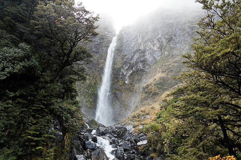
The Devils punch bowl waterfall is a very popular trail, although difficult to photograph because it’s just so big. It was quite impressive after the heavy rains of the previous days.
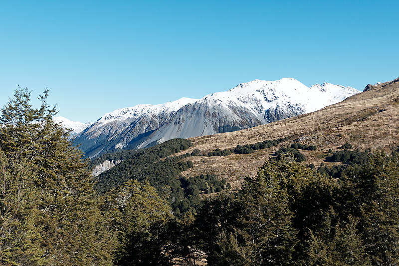
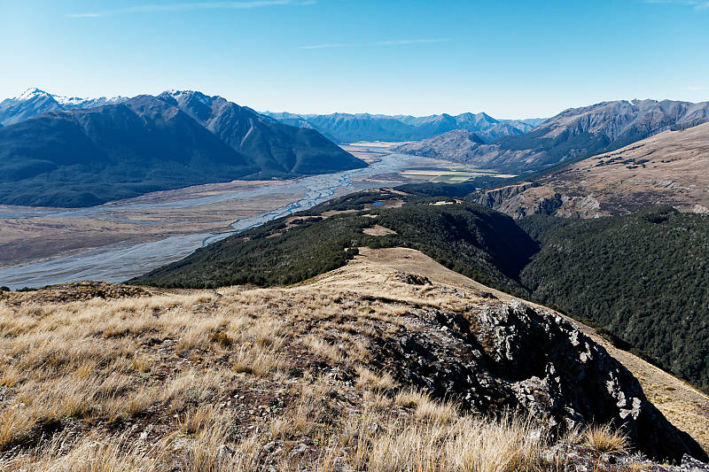
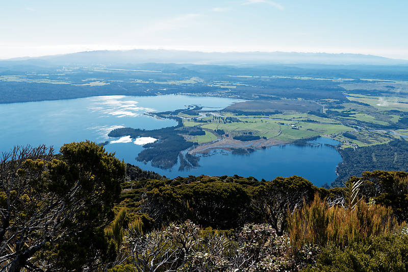
We then hiked the Bealey spur track up to the Bealey hut. Again, a nice, well formed trail. After Bealey’s hut the trail continues, which we didn’t do the first day. Tim came back the next day while Deb took a day off, and hiked past the hut, up to the ridge peak about 2.5 km past. Tim then continued another km or to see North over the valley. Well worth the extra climb up to the peak, as the views are amazing. The picture below looks back towards the hut, but the view has mountain ranges in every direction.
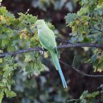
Meantime during Deb’s day off, she went to Arthur’s pass cafe for a coffee and to check in on WiFi. On the way back, she was stopped by a cheeky Kea, who was begging for food. The Kea hopped up the sidewalk and grabbed her pant leg with his foot. We know better than to feed Keas, but the Kea didn’t like Deb following the rules and nipped her on the leg! Smile. Had to shush him away. Funny. Unfortunately Kea’s are endangered now, partially because people feed them.
Upper Otira valley track
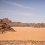
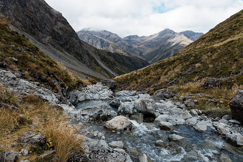
We went up the Otira valley track, past the footbridge to the warning signs. Or, as the Department of Conservation (DOC) agent called it, the “you will die” sign. But he had told us that as long as we were experienced hikers, and knew what we were doing, it was safe for us to continue up the trail. We did, rock hopping up the river bed rocks until we could see the end of the valley. (or at least the apparent end)
A few more days of heavy rain. We went out to eat in one of the two cafes here in town. Pretty basic food, but a nice change of pace. The rain was so hard that water was pooling up on the sidewalks and streets deep enough to get our shoes soaked.
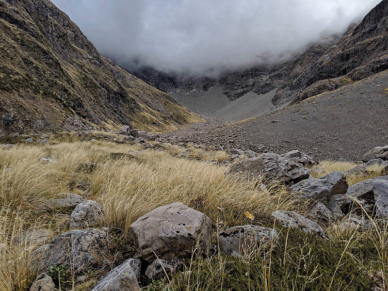
After the rain cleared, we hiked the Bealey valley track. (Not sure who Bealey was, but he must have been an important guy around here!) A good trail, and we were able to follow it most of the way up. A blustery, cool day, but we had enough warm clothing.
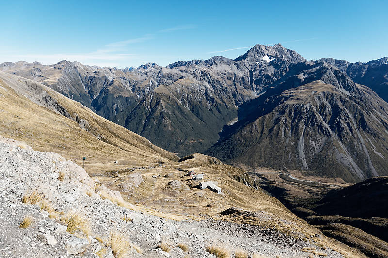
The picture above is looking down towards the start of the trail, the picture below is the scree field valley and the end of our trail.
Nice lunch view looking across the valley. Blustery day and further up the track the colder and windier it got.
We then hiked the Bealey hut/Lagoon saddle track, but not all the way to the Lagoon hut. Less impressive views than our earlier hikes, but we might just be spoiled! The heavy rains did deposit a lot of snow on the mountain peaks, so that was pretty.
Mount Te Kinga trail
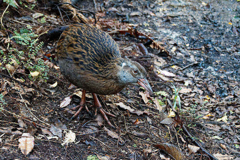
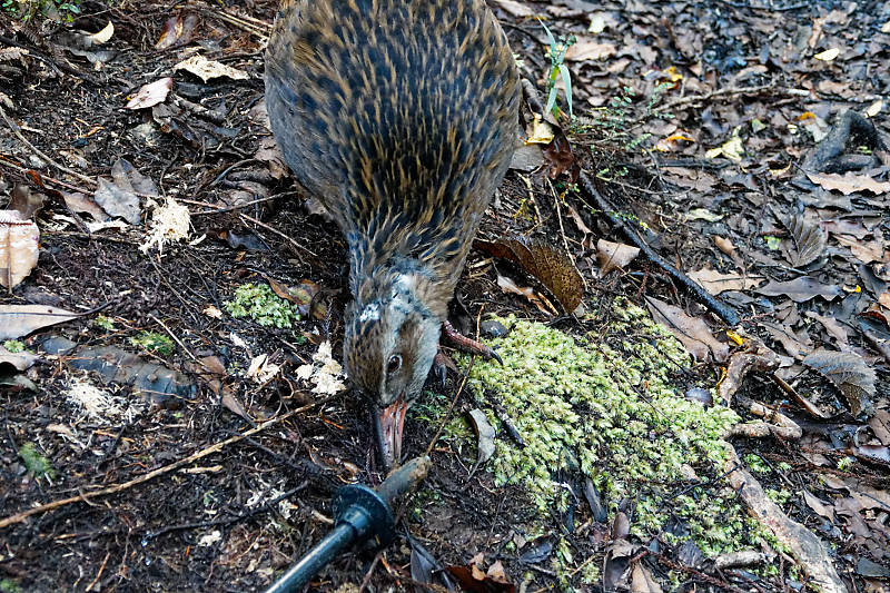
Last, we did the Mount Te Kinga Mountain trail. The views were less impressive, but we did see a Weka who was quite curious about us. We came across him about 10 meters ahead of us, and as we stayed quiet he gradually worked his way over to see us, foraging as he went. He was curious about our hiking poles, wondering if they might be edible!
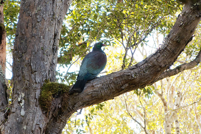
We also saw several NZ wood pigeons, along with Tui and friendly fantails.
Next it’s on to Saint Arnaud’s, more details to follow when we get a chance!